


High Above Texas, the Vast State’s Borders Become Meditations on Diversity
Jay B. Sauceda Flew 3,822 Miles Around the Perimeter of Texas Over Five Days
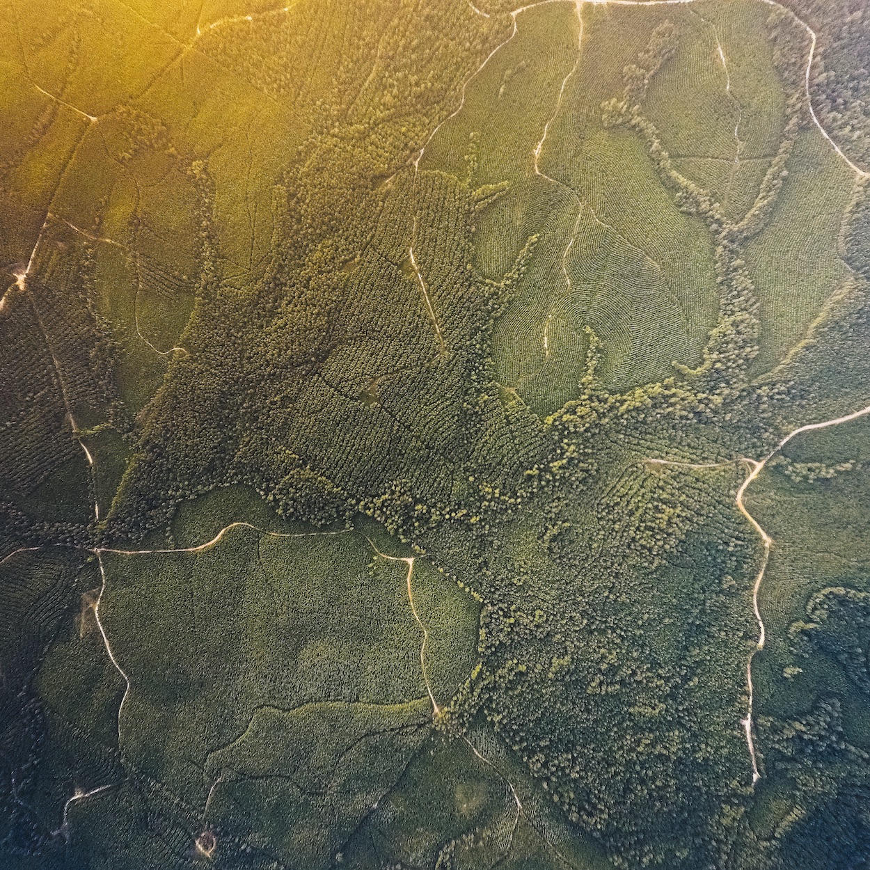
KASL—Harrison County Airport. Leg 1 / Day 2 / 9:15 PM. Photo by Jay B. Sauceda. Courtesy of University of Texas Press.

KVCT—Victoria Regional Airport. Leg 1 / Day 1 / 6:29 p.m. Photo by Jay B. Sauceda. Courtesy of University of Texas Press.
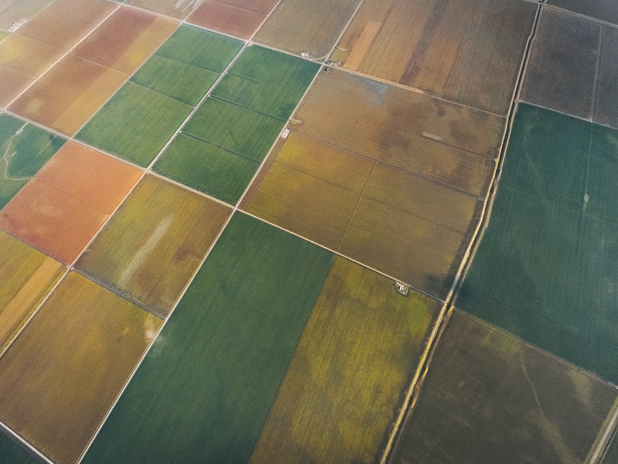
Farm Lane Northwest of San Antonio Bay. Leg 1 / Day 1 / 6:53 p.m. Photo by Jay B. Sauceda. Courtesy of University of Texas Press.

Northern Edge of East Matagorda Bay. Leg 1 / Day 1 / 7:47 p.m. Photo by Jay B. Sauceda. Courtesy of University of Texas Press.
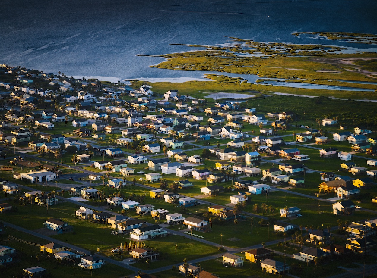
Beach Houses North of San Luis Pass. Leg 1 / Day 1 / 7:55 p.m. Photo by Jay B. Sauceda. Courtesy of University of Texas Press.

Galveston Bay. Leg 1 / Day 1 / 8:26 p.m. Photo by Jay B. Sauceda. Courtesy of University of Texas Press.
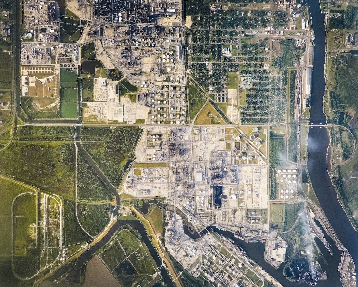
West Port Arthur. Leg 1 / Day 2 / 7:21 p.m. Photo by Jay B. Sauceda. Courtesy of University of Texas Press.
Somewhere Between Texas and Louisiana. Leg 1 / Day 2 / 7:48 p.m.Photo by Jay B. Sauceda. Courtesy of University of Texas Press.
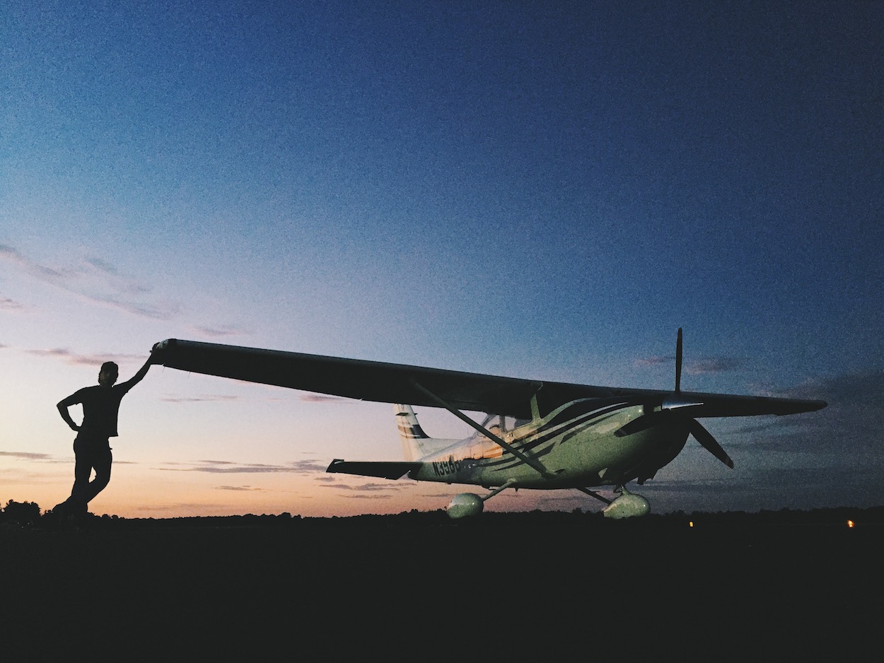
With borders and divides—both physical and ideological—making headlines daily, it’s refreshing to experience them though art. Photographer, entrepreneur, and author Jay B. Sauceda flew 3,822 miles around the perimeter of Texas over five days in 2015, taking aerial photographs along the way. The resulting images illustrate the stunning diversity of the state’s landscape. Rows of crops display gorgeous symmetry. The texture of sand dunes nearly leap off the pages. Rivers and roads wind beneath puffy clouds, mesmerizing sunsets, and approaching storms.
A Mile Above Texas, published by University of Texas Press, is mostly made up of big and bold images but also includes flight log entries from Sauceda, who piloted a single-engine Cessna while simultaneously taking the photos via handheld cameras and GoPros attached to the wings. He explains in a brief introduction that the photography project, which was originally an assignment for Texas Monthly magazine, ultimately “was an excuse for a photographer to cover a subject he had been supremely interested in professionally, while partaking in a passion he had grown up obsessed with.”
Send A Letter To the Editors