


It’s a hot and angry September, and your boss or your spouse has just told you to take a hike. But where?
![]()
Hiking usually means mountains, and California has more than its share of bucket list summits. Half Dome draws the tourists. Mount Whitney is the tallest. Mount Shasta is the prettiest. And there are few experiences more mystical than a tram ride up San Jacinto.
But for most Californians, these are not middle-class, everyday peaks. They are destination mountains, beautiful and stunning because they stand so far apart from where most of us live and work. And so while we admire their greatness, we cannot see ourselves in them.
No, the three greatest mountains of California stand lower, but closer. They do not make most tourist guides, and many Californians may not have heard of them all. But they offer panoramic views that allow us to look at ourselves, and thus help define us.
This summer, I made a point of going to the top of all three. First was my hometown peak, Mount Wilson, part of the San Gabriels, from which I peered over greater Los Angeles from 5,710 feet. I grew up in the mountain’s shadow, in Pasadena; my mother, not a religious sort, once suggested that if there was a God, He lived inside the mountain, which still seems as good an answer as any offered by organized religion.
Mount Wilson has the best view of Southern California’s sprawl, but it also defines the narrowness of our vision here. The San Gabriels and other mountains wall off our region, making us, in the words of the late author Carey McWilliams, “an island on the land” and “another country.” You literally can’t see the rest of California from Southern California. So we are stuck, trapped, looking at ourselves. And at our stars, if you stop by the historic Mount Wilson Observatory.
A week after driving to the top of Mount Wilson, I made a far lesser climb, in La Jolla, to the top of Mount Soledad, which stands just 822 feet above sea level. But the view from that spot, of the Pacific to the west and mountains to the north and San Diego and the border to the south, was somewhat grander.
Mount Soledad’s summit is perhaps best known as home of a landmark 43-foot cross, the subject of a court battle over whether it represents an unconstitutional establishment of religion. My own revelation up there was less about the Savior and more about San Diego. Los Angeles and San Francisco are (purely as a geographical matter) on the ocean, but those cities are oriented away from the Pacific—L.A. toward the inland valleys and San Francisco toward the Bay. To see San Diego from atop the mountain was to see how this is California’s true seaside city. The buildings and the people strain to face the rare and natural harbor.
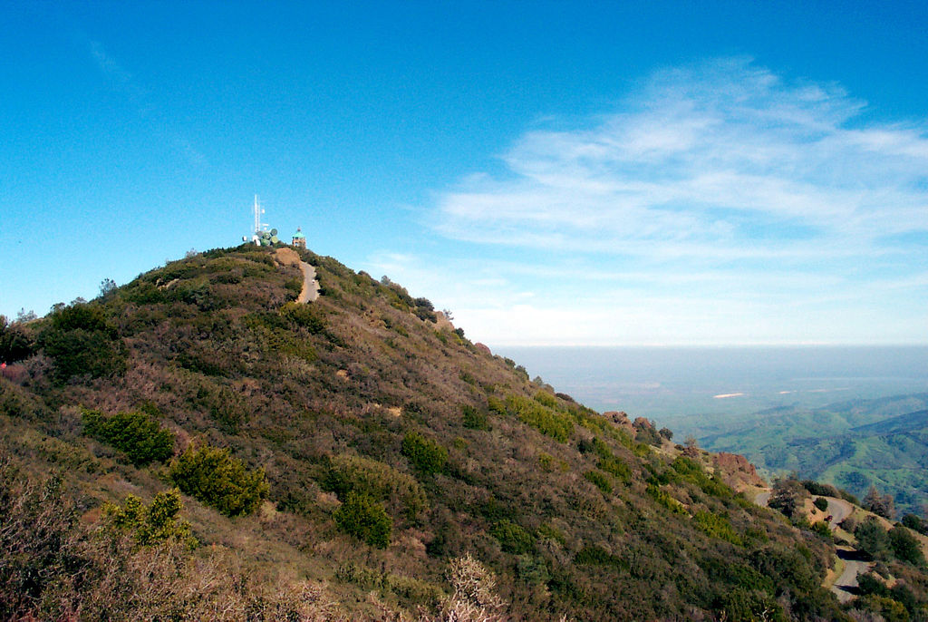
While I had visited Soledad and Wilson before, I had never been to the top of the third peak, Mount Diablo, 3,849 feet above the East Bay suburbs. Heck, as someone who grew up in Southern California, I had never even heard of Mount Diablo until I was in my 20s and traveling the state as a reporter.
If Mount Diablo remains a mystery to you, you ought to remedy that, and fast. As I learned after paying $10 to enter (Mount Diablo is a state park) and making a slow 40-minute drive to the summit from the town of Danville, there is simply no better—and no more important view—anywhere in California.
Indeed, the 360-degree panorama is so encompassing it’s hard to even list all of what lies before you. The highlights: the Golden Gate and the Farallon Islands, the San Francisco Peninsula, the East Bay, the South Bay, eight different bridges, the Santa Cruz Mountains, the Coast Range, Mount Lassen of the Cascades (with binoculars), the Central Valley, the foothills of the Gold Country, the Sierras, and in the foreground, the majesty of the Delta, our parched state’s stressed-out water source. A sign said that Yosemite Park is visible, but even with binoculars on a very clear day, I couldn’t make it out.
Mount Diablo might be the closest thing California has to a geographic center. That has a historic basis. In 1851, Colonel Leander Ransom and his men chose the top of Diablo as the starting point for official land surveys, extending base and meridian lines out from here. Real estate through much of California, as well as in Nevada and Oregon, is still described in legal documents based on those lines.
Mount Diablo remains a rare, and underappreciated, reference point for a state that can be devilish (OK, so I couldn’t resist) to understand. That doesn’t mean that California made sense to me as I stood on top of the mountain. It would take several lifetimes to begin to know all the places you could see from the top.
But, like Jeffrey Lebowski’s rug or our university systems, Mount Diablo really ties the place together. California is all about divides and separations. But here, not too high above the fray, we could meet.
Send A Letter To the Editors