


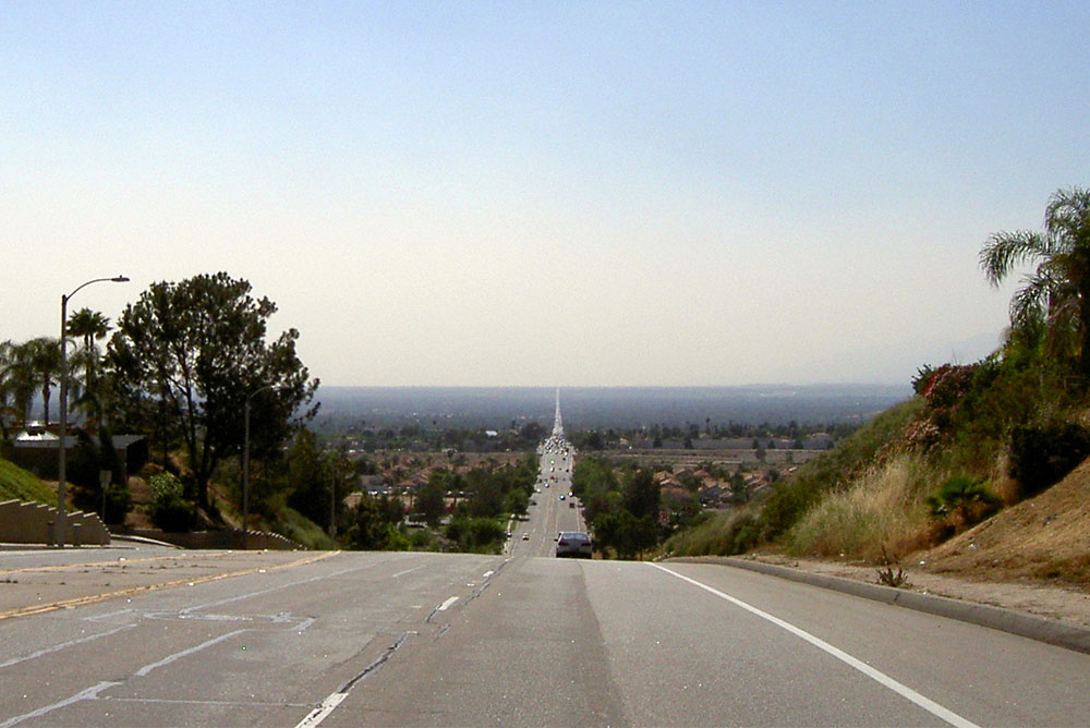
Baseline Road, Highland, California. Courtesy of Wikimedia Commons/Americanist.
Don’t ever complain about freeway traffic, especially around my mother.
“You’re lucky to have freeways—when I was a kid, we didn’t have freeways,” she used to say.
But that didn’t stop my brother and me from whining about congestion on the 10 during long drives to see her relatives in Redlands. She’d respond to our complaints with the Southern California version of “when I was your age, I had to walk six miles through the snow.”
“I grew up in Hawthorne,” a working-class town near LAX, she’d remind us, “and when we went to Redlands, we had to go via Imperial Highway and other surface streets.” In her telling, the trip took three hours.
Mom is 75 now, and her memory isn’t great. But I’ve never forgotten her story, and for years I’ve wondered what such a trip would be like. So, with her encouragement—she’s a retired newspaper editor who taught me the old journalists’ adage, “if your mother says she loves you, check it out”—I decided to do the reporting. I would drive from Hawthorne to the Inland Empire city of Redlands without getting on a freeway.
The drive would trigger memories, inspire emotions, and serve as a reminder how, when you’re traveling in California, time can slow down even as it hurtles ahead.
I start near Imperial Highway’s western end in El Segundo, from the former site of the North American Aviation plant where Grandma Edith, my mom’s mom, once worked the assembly line. From that spot, I see the office building that is now home to the L.A. Times, the paper my mom and I both worked for when it was headquartered in downtown L.A. From El Segundo, the highway proceeds underneath the 105 Freeway, which effectively replaced Imperial as an east-west thoroughfare when it opened in 1993.
Imperial Highway—really a collection of four- and six-lane county roads and state highways, with stoplights—was first conceived of a century ago by agricultural and business interests who wanted to connect L.A. with farms around Brawley, 220 miles southeast in Imperial County.
But building infrastructure was never easy in this state of too-many local jurisdictions; construction on the highway got started in 1931 but wasn’t finished until 1961. The Imperial Highway my mom and her parents relied on in the 1950s and ’60s slowly became obsolete as long stretches of the highway were replaced or subsumed by other freeways and highways. Today, Imperial Highway doesn’t come within 100 miles of Imperial County; its eastern end is at the border of Anaheim and the city of Orange.
Heading east from El Segundo on Imperial, I stop immediately in Hawthorne, at a small apartment building that occupies the lot where my mom grew up. I also swing by the monument to the Beach Boys, whom my mom knew at Hawthorne High School. From Hawthorne, Imperial passes briefly through Inglewood and then makes its way through South Los Angeles, the section of Southern California that has changed the most, and most consistently drawn my attention, throughout my career.
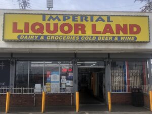
Courtesy of Joe Mathews.
To drive Imperial Highway today is to see Southern California as an unhealthy empire, at war with itself. There are more check cashing places than banks, and more liquor stores, fast-food restaurants, donut shops, and smoke shops than I can count, most in small strip malls with names like “Imperial Plaza.” Their sun-splashed marquees mix with newer health clinics and gleaming schools—public, charter, private, and religious—often fenced off.
This streetscape reflects dueling impulses. Will health care and education save us before we eat and drink ourselves to death?
Just as in the rest of California, there is not enough new housing here. Homes along Imperial are often stucco and mid-century, their ugliness hidden behind uglier walls that block the traffic noise. The two public housing projects I pass—Nickerson Gardens and Imperial Courts—are in better shape than the apartments and motels around them.
East of South L.A., after grabbing a burrito at Plaza de Mexico mall in Lynwood, I can’t help but stop when I see the street sign for Gary Beverly Court outside of an empty Lynwood High School building. The high school has moved, but the street sign remains, in honor of a beloved principal who was shot to death on his drive home 20 years ago. I covered the case, which remains haunting and unsolved.
With a multi-car accident blocking Imperial ahead, I take a mile-long detour south into Compton, which allows me to visit the tombs of my great-grandparents. When I return to the road, I head through South Gate, and battle traffic. The retail shops become more frequent and more middlebrow in Downey. There, a sign points me in the direction of the museum memorializing the Columbia Space Shuttle, which my grandmother helped assemble later in her aerospace career.
Traffic is slow in Norwalk, with county government buildings and churches that have taken over old hotels, auditoriums, and restaurants. The drivers go so fast in Santa Fe Springs and La Mirada, the last two L.A. County cities Imperial runs through, that I move over to the slower right-hand lane.
Forty-one miles in, when I cross into Orange County in La Habra, Imperial looks more prosperous. There are a couple of tech firm offices, as well as high-end retailers, gyms and yoga studios full of pretty people, and an Amazon Fresh. I push through Brea into Yorba Linda for a bit, and see a few horse trails, along with signs for the Nixon library, devoted to the only California-born president, a kid from Whittier who weirdly embodied the promise and paranoia of his home state.
My total drive time, not counting stops, has reached two hours. And Imperial Highway would only get me halfway to Redlands, in the northeast corner of the L.A. basin that is part of San Bernardino County.
So, I turn north and head through Brea Canyon on a dusty, traffic-crammed road paralleling the 57 Freeway. Upon reaching the San Gabriel Valley, I take surface streets in a northeast direction through Diamond Bar, Pomona, and Claremont—passing a familiar mix of fast-food joints and donuts and schools.
Without a map, I drive in search of Base Line, where I’ll turn eastward. It’s the road my mom remembers most from those long-ago drives.
It also was once among the most important routes in all of California.
Indeed, Base Line is older than almost everything now standing in the Los Angeles basin. In the 1850s, U.S. government surveyors, charged with establishing an “initial point” for Southern California surveys (they chose Mt. San Bernardino), established a north-south meridian line and an east-west baseline to guide future surveys.
That baseline became Baseline, which today goes by various names—Base Line or Baseline, Baseline Avenue or Baseline Street, or, in Upland, 16th Street. At the point beyond Claremont where I reach Baseline, I find a dustier, less dense version of Imperial Highway, with three lanes and too many liquor stores, but with more parks and trees and vacant lots. Just as the 105 Freeway shadows Imperial, the 210 tracks the Baseline corridor it replaced over the past two generations.
The housing is newer here—my mom recalls the Base Line as a strip of development and services, running largely through groves and farms. But the buildings seem sun-bleached and in need of repair—a reminder that California’s housing stock is older than that of the Rust Belt states.
I head through Upland, with ranch houses and a few parks, and then into Rancho Cucamonga, which seems to have an abundance of dental practices along Baseline. “Why all the dentists?” I ask myself, before answering my own question: it’s all the donut shops!
I am through Etiwanda and into Fontana before I spot new housing construction, a development calling itself “The Encore at Providence,” which sounds like the last song before the show ends and you get your audience with God.
But then in Rialto, Baseline becomes a divide. On the south side are homes, protected by sound walls. On the north side are warehouses. These facilities grow more massive as I move further east; the “Now Hiring” signs on their walls also get bigger as I head deeper into the Inland Empire, now an American center for logistics.
Sidewalks are replaced by dust, and the landscape gets browner, except for the brilliant green colors of Eisenhower High School. I feel like I’m in the country, with things spread out—until I cross the 215 and enter the west side of San Bernardino.
To this point, the roads have been relatively smooth, but San Bernardino is a poor city, even after emerging from one of America’s worst municipal bankruptcies in 2017. Baseline here is full of ruts and potholes, and my Prius bounces up and down. Many of the storefronts are empty. Even in the Inland Empire, one of California’s fastest-growing areas, San Bernardino seems stagnant; it’s been eclipsed by its inland urban rival, Riverside, which has grown faster and richer since the 1980s.
I’ve been driving for more than three hours, and I’m getting close to my destination. I head through the city of Highland, home of the San Manuel Band of Mission Indians, who sponsor the new event space back in L.A. that the media nonprofit for which I now work helps program. I drive a few miles past their newly renamed casino and I’m in East Highlands, where my grandmother, great-grandmother and other relatives worked in the orange groves and packing houses after arriving from Oklahoma during the Dust Bowl.
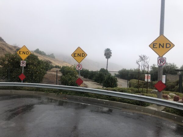
Courtesy of Joe Mathews.
The packing company provided a small green house for the family to live in here in East Highlands; that’s where my mom was heading from Hawthorne six decades ago. That green house, in a line of houses once known as the Green Row, is long gone, but I find the spot, on a hillside in a planned community.
Baseline dead-ends at an orange grove, which provides a bit of agricultural respite, and beauty, between the development and a dry hillside crisscrossed with hiking trails. Many of the oranges lay unpicked, rotting on the ground.
My great aunt and uncle, Fern and Don, remain in Redlands, near the 800-square-foot house my great-grandparents saved up to buy and which we would visit on those traffic-choked drives on the 10. I turn south, taking Orange Street through the Redlands downtown and up to the retirement community where Fern and Don now live.
More than eight hours have passed since I started. My total drive time, excluding stops, has been more than four hours. But the journey has felt even longer, with time moving in reverse as I retrace my mom’s family drives from six decades ago, and follow thoroughfares that date to the mid-19th and early 20th centuries.
After navigating the community’s COVID checks, I knock on my aunt and uncle’s door. I hug Fern, and spend a half hour arguing good-naturedly with Don about what he’s watching on Fox News. But I am eager to get home, without delay.
In less than five minutes of driving, I’m on the 10, heading west toward L.A. This drive will take me only 90 minutes, because of some traffic around West Covina. The route is not particularly scenic. But as I drive home, I suddenly feel fresher and renewed—with new memories of Southern California surface streets, and with my mother’s enduring gratitude for our freeways.
Send A Letter To the Editors